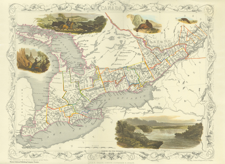
Map of West Canada
item
- Title
- Map of West Canada
- Date
- 1838 (original)
- 1967 (reproduction)
- Creator
- Wallis, Rob
- Rapkin, J.
- Extent
- 38 x 26 cm
- Is Part Of
- Niagara Falls Public Library Art Collection
- Description
- en-CA A reproduction of a Bartlett print of 1836
- en-CA The illustrations by H. Warren, and engraved by Rob Wallis ;
- en-CA The Map, drawn & engraved by J. Rapkin ;
- Type
- Still Image
- Medium
- Colour print on paper
- Subject
- Maps
- Location
- Canada
- Identifier
- http://www.nflibrary.ca/nfplindex/show.asp?b=1&ref=oo&id=246274
- Publisher
- J & F Tallis, London, Edinburgh & Dublin (original)
- Musson Anderson Publishing Company, Toronto (reproduction) ;
- Date Created
- 2005-08-12
- Date Modified
- 2005-08-12
- Media
 Map of West Canada
- Item sets
- Art database