Browse Items
Search full-text
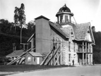
niagara falls bridge commission
-
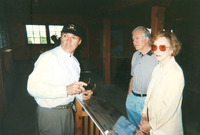
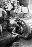 Opening of Karel Soucek's barrel. FALLS NIAGARA POLICE PARKS
 -
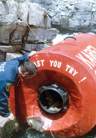 Opening of Karel Soucek's barrel. FALLS NIAGARA POLICE PARKS
 -
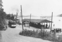
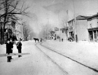 Main Street at Ferry ST SLEIGH SLEIGHS HORSE HORSES SNOW ICE
 -
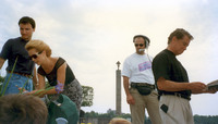 Kathie Lee Gifford and Regis Philbin Signing Autographs Visit was for the filming of Live with Regis and Kathie Lee held in Oakes Garden Theatre
 -
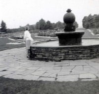 School Of Horticulture Niagara Parks Commission School of Horticulture Fountain
 -
 Whirlpool Rapids Incline 5" by 7"
 -
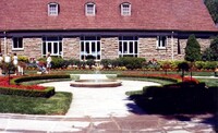
 Rear of Oak Hall from below digital colour image
 -
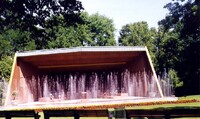 Bandshell at Queenston Heights ready for a Sunday afternoon concert From the personal collection of Ruth Deacon ;
 -
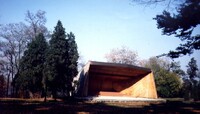 Bandshell at Queenston Heights in the Fall From the personal collection of Ruth Deacon ;
 -
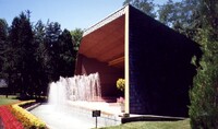 Bandshell at Queenston Heights - side view From the personal collection of Ruth Deacon ;
 -
 Queenston Heights Restaurant From the personal collection of Ruth Deacon ;
 -
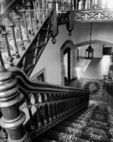 Oak Hall - interior view of ornate staircase date not known
 -
 Louis Tussaud's Wax Museum seen from Oakes Garden Theatre buildings, signs, advertisement, tourist attraction, businesses
 -
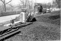
 International Railway Company Great Gorge Route - car barn & siding at Whirlpool I.R.C. car, i.r.c. barns paRK RIVER RAILROAD
 -
 Queenston Docks and the Canada Steam Ship dock 10" x 8" Heritage Foundation
 -
 Oakes Garden Theatre Colour photograph
 -
 Oakes Garden Theatre This photo was taken as part of the Niagara Falls International Photo Contest
 -
 Toronto Power Company Plant - Frederic Nicholls (centre with trowel in hand) laying one of three cornerstones To the right of Mr Nicholls (wearing silk topper) is a Mr Value who was Chief Engineer for the Company ; next (wearing short coat and bowler hat) is Mr Hirt ; extreme right and partially in the picture is James Wilson Superindent of the Niagara Parks Commission from 1887 - 1908 ; behind Mr Nicholls (moustache, bow-tie and bowler hat) is Mr Pearson of the Pearson Engineering Corporation of New York
 -
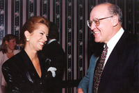 Kathie Lee Gifford and George Bailey TELEVISION SHOW OAKES GARDEN NIAGARA PARKS COMMISSION
 -
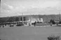
 Oakes Garden Theatre Landscaping at Oakes Garden Theatre
 -
 Hotel General Brock Hotel General Brock in the background and a small area of Oakes Garden Theatre in the forefront.
 -
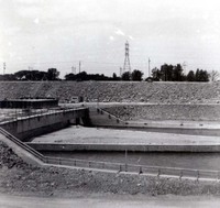 Hydro Dam Hydro dam
 -
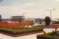
 Floral Clock Floral Clock
 -
 Oakes Garden Theatre with Community Plate in the background Oakes Garden Theatre with Community Plate in the background
 -
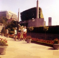 Tourists at Oakes Garden Theatre Tourists at Oakes Garden Theatre
 -
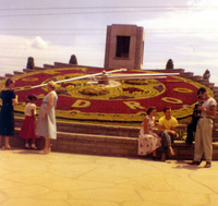
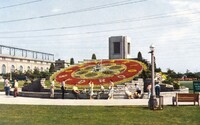 Floral Clock Ontario Hydro's Floral Clock
 -
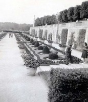
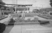
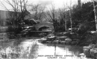
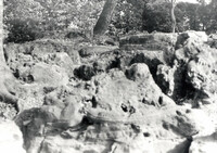 Oakes Garden Theatre Rock Garden Rocks in the rock garden at Oakes Garden Theatre
 -
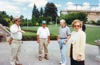 Former President Jimmy Carter and his wife Rosalynn visit the Floral Clock Former U.S. President Jimmy Carter and his wife Rosaylnn visit the Floral Clock.
 -
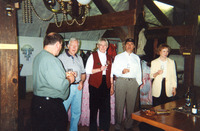 Former President Jimmy Carter and his wife Rosalynn at Inniskillin Winery Former U.S. President Jimmy Carter with his wife Rosalynn at Inniskillin Winery enjoying a drink with the owner Donald Zivaldo and Debbie Pratt
 -
 Former President Jimmy Carter and his wife Rosalynn at Inniskillin Winery Former U.S. President Jimmy Carter and his wife Rosalynn at Inniskillin Winery with the owner Donald Zivaldo
 -
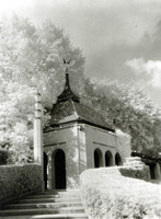 Oakes Garden Theatre A structure and stairway in Oakes Garden Theatre
 -
 Oakes Garden Theatre Oakes garden theatre
 -
 Oakes Garden Theatre Oakes garden theatre
 -
 Oakes Garden Theatre The rock garden at Oakes Garden Theatre.
 -
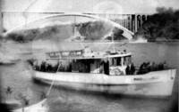
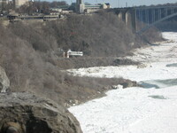 Ice in the lower Niagara River in Winter The maid of the Mist in drydock next to the frozen Lower Niagara River. The Rainbow Bridge can be seen in the background.
 -
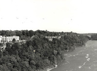
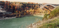
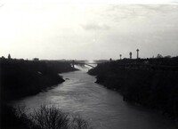 Niagara Gorge and River A view of the Niagara Gorge and River with the Rainbow Bridge
 -
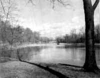
 Upper Niagara River View of the Upper Niagara River
 -
 Lower Niagara River View of the Niagara River
 -
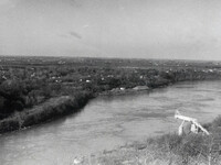
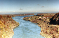 Lower Niagara River The lower Niagara River taken from the Queenston-Lewiston Bridge.
 -
 Lower Niagara River in winter Lower Niagara River in winter looking north towards the Queenston-Lewiston Bridge at the Sir Adam Beck Generating Station.
 -
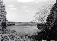
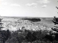
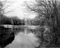
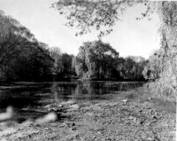
 Chippawa Creek along the Niagara River Parkway Foreground is now Niagara Boulevard; right center is Hogg Island; Willows in background, now Kings Bridge Park
 -
 View of Lower Niagara River and Queenston View of the lower Niagara River and Queenston
 -
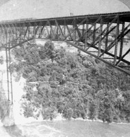
 Niagara Gorge looking towards Hubbard Point The Niagara Gorge, looking toward Hubbard Point with the Whirlpool Bridge in the background.
 -
 Lewiston along edge of Niagara River Though the image is faint, the viewing platform of the old suspension bridge can be seen in the centre of the photograph.
 -
 Lewiston from bank of Niagara River The Queenston-Lewiston Suspension Bridge (or, what remains of it) is faintly visible in centre of image. Art Park is the complex to the left.
 -
 Replacing water main pipes on the Niagara Parkway at River Road Rainbow Bridge in background
 -
 Conservation Officer A. Roy Muma of the Ontario Department of Lands and Forests & Fish & Wildlife talking to fishermen at the mouth of the Niagara River CNR Train bridge in background, location Fort Erie
 -
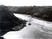 Spanish Aero Car crossing above the Whirlpool View of the Spanish Aero Car crossing the Niagara Gorge above the Whirlpool
 -
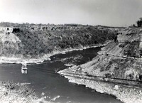 Spanish Aero Car crossing above the Whirlpool View of the Spanish Aero Car crossing the Niagara Gorge above the Whirlpool
 -
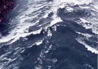
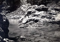 Cripps Eddy Cripps Eddy located along the Canadian shore of the Niagara River just north of the whirlpool. This is a photo of a "low tide" occurence, taken the same day as a similar "high tide" photo.
 -
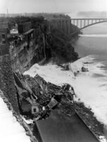
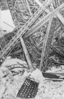 Twisted Girders After the Collapse View of U.S. side of the collapsed Upper Steel Arch Bridge. From a Buffalo Evening News photograph in the Buffalo Erie County Historical Society, Buffalo, N.Y.
 -
 Construction of Ontario Hydro tunnels for the Sir Adam Beck - Niagara Generating Station #2 LCN 10170353LCN 17294973
 -
 Construction of Ontario Hydro tunnels for the Sir Adam Beck - Niagara Generating Station #2 LCN 10170353LCN 17294973
 -
 Construction of Ontario Hydro tunnels for the Sir Adam Beck - Niagara Generating Station #2 LCN 10170353LCN 17294973
 -
 Construction of Ontario Hydro tunnels for the Sir Adam Beck - Niagara Generating Station #2 LCN 10170353LCN 17294973
 -
 Construction of Ontario Hydro tunnels for the Sir Adam Beck - Niagara Generating Station #2 LCN 10170353LCN 17294973
 -
 Construction of Ontario Hydro tunnels for the Sir Adam Beck - Niagara Generating Station #2 LCN 10170353LCN 17294973
 -
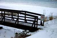 No Swimming - Moore Island in winter bridge Ussher's Creek Street's Creek upper river
 -
 Maid of the Mist Type:boiler, boat; No. of negatives: 6; Photos included: 0; Notes: includes boiler and photos of Maid of the Mist in river; Client: Aeroquip Canada
 -
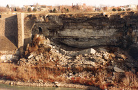 Remains of the Schoellkopf Power Station Remains of the Schoellkopf Power Station on the American side of the Niagara River, slightly downstream from the Rainbow Bridge. It collapsed into the Niagara River on June 7, 1956
 -
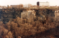 Remains of the Schoellkopf Power Station Remains of the Schoellkopf Power Station on the American side of the Niagara River, slightly downstream from the Rainbow Bridge. It collapsed into the Niagara River on June 7, 1956
 -
 Clifford Calverly performing on a 7/8" wire cantilever bridge
 -
 Collapse at Schoellkopf Power Plant A side-angle shot of the collapse of the Schoellkopf Power Plant. Notice the water surging from the exposed penstocks at the base of the gorge. Rainbow Bridge is in background.
 -
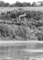
 Smeaton Ravine from across river Lewiston-Queenston Arch Bridge is on right side of image.
 -
 Unknown photograph - Probably Ontario Power Plant workers, can you name them? two unknown persons standing on the ice next to the collapsed Steel Arch/Honeymoon Bridge January 1938 ; photograph was taken by Norman S Smith a worker at the Ontario Power Plant but the persons are unidentified ;
 -
 Observation Tower at Lewiston The platform seen here is built upon the enforcing towers of the former Queenston-Lewiston Suspension Bridge.
 -
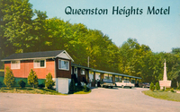 Queenston Heights Motel Reverse includes a map and reads highway 8A at Niagara Parkway below Queenston Heights half mile from Lewiston Bridge, 405 highway ; phone 262-4513 Mrs Mike Brotzel, PO Box 94 Queenston, Ontario ;
 -
 Queenston from the American side Queenston from the American side. The platform is a lookout for Artpark on the location where the towers of the old Queenston - Lewiston bridge were.
 -
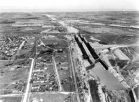 Construction of Flight Locks at Thorold Flight locks
 -
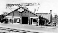 John Robinson's Fireproof Garage - River Road Now part of the Rainbow Bridge approach structure
 -
 Chippawa Harbor Chippawa Canada Chippawa Bridge in background (left) ; houses on the bank of the River (centre right)
 -
 Chippawa Village Harbour - Hydro Dredge in background Temporary wooden bridge from Front St. to Laura Secord Place in background ;
 -
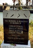 Garden City Skyway St Catharines - Memorial honouring four men killed in workplace accident HOMER CONRAD STENZEL DOUGLAS SHAND DAVID MCKINLEY GORDON THOMAS
 -
 River Road, construction of Rainbow Gardens, General Brock Hotel (left) ... The paved area to the right on which the wheelbarrow is parked is the former entrance to the Upper Steel Arch Bridge. F. H, Leslie (owner Niagara Falls Review) employed a Mr Gonder who took the photograph ... - George Seibel ;
 -
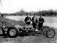 Boys standing by a Drag Racer with Chippawa Creek in the background John Bevan, Rick McCarthy, Larry Wall, Mac McArthur
 -
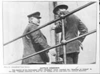 Captain Anderson of the Ship " Storstad, " boats, Master Norwegian collier ram Empress of Ireland fog bridge Montreal sank sunk
 -
 The Elgin House (Left) and The Erie & Ontario Railway Depot (Right) (c.1910) B&W photograph
 -
 West Main Street Humberstone Ont [Ontario] Horse and buggy (centre) ; sign (centre left) reads "Any person riding or driving on or over this bridge faster than a walk will be fined according to law. No person will be allowed to enter upon it once in motion or about to be turned" ;
 -
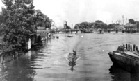
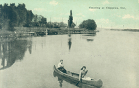 Canoeing at Chippawa Ont [Ontario] Two women identified as Helen Rapeljie in the stern and Eleanor Bukator in the bow paddling in Chippawa ; electric railway poles in background ; verification of identity provided by Eleanor Bukator February 9 1975 ; in background can be seen the old mouth of Chippawa Creek which has now (2008) been filled in and is known as King's Bridge Park ;
 -
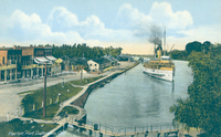
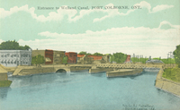 Entrance to Welland Canal Port Colborne Ont [Ontario] The third Welland Canal as it passes through the centre of Port Colborne, stores and businesses (left) ; canal bank and hydro poles (right) ; lock bridge (centre)
 -
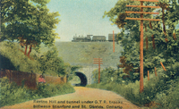 Ravine Hill and tunnel under GTR [Grand Trunk Railroad] tracks between Stamford and St David's Ontario Looking north toward St David's ; the tunnel and bridge made of stone are located at the bottom of Ravine Hill ; a train is crossing on the tracks ;many trees line the dirt road ; wooden hydro poles (right) ; a woman is standing under the trees to the left ;
 -
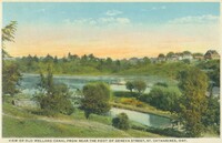 View of Old Welland Canal from near the foot of Geneva Street St Catharines Ont [Ontario] The canal is in the lower half of the image ; a bridge crosses over the canal (lower right) ; houses in distant background ;
 -
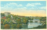 Looking east on the Old Welland Canal St Catharines Ont [Ontario] Factories in background right and centre ; canal in foreground ; bridge in background right ;
 -
 Harbor Port Dalhousie Ont [Ontario] The steam ship is shown approaching the dock in Port Dalhousie harbour ; ship is probably the Dalhousie City which brought tourists in from Toronto ; ship comprises two decks and had one funnel which is belching steam ; the village of Port Dalhousie is to the left ; various brick businesses with porches line the street that runs along the harbour side ; a small foot bridge (bottom centre) ;
 -
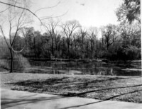
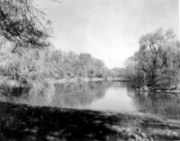
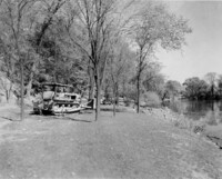
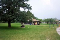
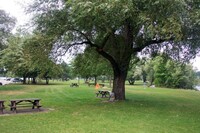
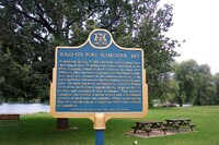
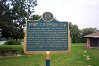
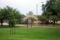
 Kingsbridge Park King's Bridge Park
 -
 Kingsbridge Park Kings Bridge Park
 -
 Kingsbridge Park King's Bridge Park
 -
 Kingsbridge Park King's Bridge Park
 -
 Kingsbridge Park King's Bridge Park
 -
 Kingsbridge Park King's Bridge Park
 -
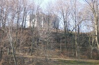
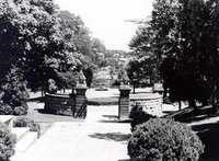 Queenston Heights Park Stairway down to stone gates at Queenston Heights Park
 -
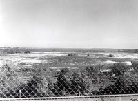
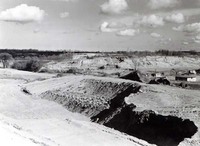 St. David's Sand Pits The St. David's sand pits