Browse Items
Search full-text
niagara falls bridge commission
-
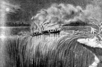 Artists sketch of the Steamer Caroline on Fire at the brink of the Horseshoe Falls The burning Steamer Caroline, with 10 people aboard, went over the Horseshoe Falls, on the night of December 29, 1837
 -
 Artists sketch of the Steamer Caroline on Fire at the brink of the Horseshoe Falls boat night, December 29 1837
 -
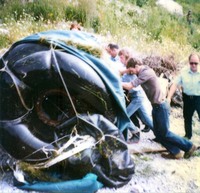 Steve Trotter's Innertube Barrel in which he went over the Horseshoe Falls Steve Trotter, a 22 year old part-time bartender from Barrington, Rhode Island went over the Horseshoe Falls on August 18, 1985. His device was made of 2 plastic pickle barrels surrounded by large innertubes and covered by taraplin. This photo shows the device after his plunge over the falls.
 -
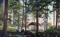
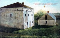
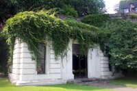
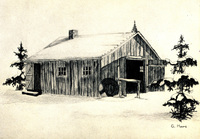 The Blacksmith Shop, Balls Falls Conservation Area, Jordan, Ontario Pencil etching of the Blacksmith Shop at Ball's Falls Conservation area.
 -
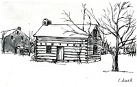 The Secord Cabin, Ball's Falls Conservation Area, Jordan, Ontario Pencil etching of the Secord cabin at Ball's Falls Conservation area.
 -
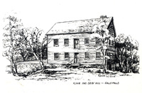 Flour and Grist Mill, Ball's Falls Conservation Area, Jordan, Ontario Pencil etching of the Flour and Grist Mill at Ball's Falls Conservation area.
 -
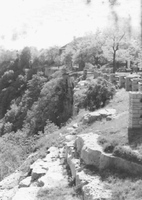
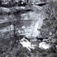 Ball's Falls Conservation Area, Jordan, Ontario The gorge and river at Ball's Falls.
 -
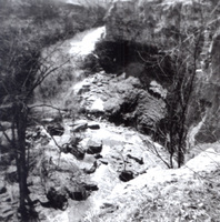 Ball's Falls Conservation Area, Jordan, Ontario The gorge and river at Ball's Falls.
 -
 Old stone house and barracks where [William] Morgan was imprisoned, Niagara The barracks were located at Fort Niagara on the United States side of the Niagara River ;
 -
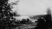
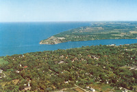 Air View of Niagara-on-the Lake Aerial view of the Town of Niagara-on-the Lake, the lower Niagara River and lake Ontario.
 -
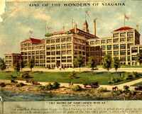 The Wonders of Niagara LCN 10167843 SHREDDED WHEAT COMPANY
 -
 General view Niagara Falls Canada LCN 17290303
 -
 General View, Niagara Falls LCN 17290097
 -
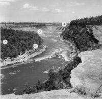 Five Stages of the Niagara Gorge LCN 10109954 ; Our Romantic Niagara
 -
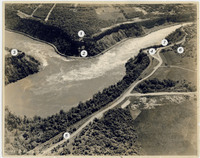 Stage IV of the Niagara River LCN 10109954 ; Our Romantic Niagara
 -
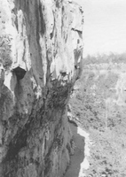
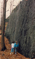 Perpendicular rock wall - Niagara Glen LCN 10109954 Our Romantic Niagara Tiplin
 -
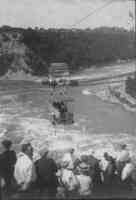
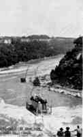
 Whirlpool Aero Car LCN 10109954 ; Our Romantic Niagara
 -
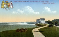
 Official guide to Niagara - Outside view of Canadian Niagara Power House LCN 10167844 COMPANY
 -
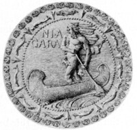 Official guide to Niagara - seal of the Canadian Niagara Power Company LCN 10167844 HOUSE GENERATING STATION
 -
 Niagara Glen - Foster's Flats, Large Pothole This Pothole was formed in the ancient Niagara River Bed, now Wintergreen Flats. Later the rock layers around it were undercut causing it to fall to the terrace below.
 -
 Niagara Parkway - looking north toward Clifton Hill Historic Niagara Development Inc.
 -
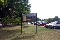 Niagara Glen- Niagara Parkway Nature Area.
 -
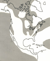
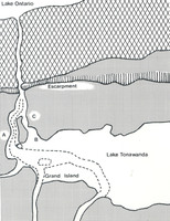 The Former lake Bed from "Our Romantic Niagara" by A.H. Tiplin This map was drawn from information contained in the United States Geological Survey of 1913. Ancient lake Tonawanda shows as merely an enlarged Niagara River which spilled over the 644 kilometres (400 miles) wscarpment at five main points - Holley, Medina, Gasport, Lockport and Lewiston in present day New York State. The Lewiston outlet prevailed to become the only outlet - the Niagara River
 -
 Bay at Niagara Glen Canada Printed in Leipzig Saxony
 -
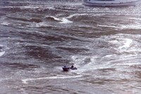
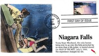 Niagara Falls U.S.A. Stamp First Day Cover / Roger Woodward Being Rescued by the Maid of the Mist marked on back Dynamite Covers 53/71
 -
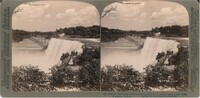
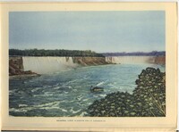
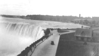
 American Falls from the Canadian side, Niagara LCN 17290297
 -
 American Falls and Rock of Ages - Niagara U.S.A. LCN 17290297
 -
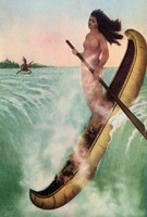 Legend of the White Canoe, Niagara Lelawala; Maid of the Mist legend
 -
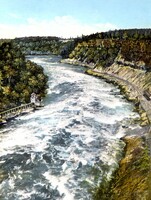
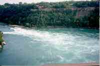
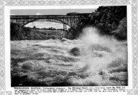 Whirlpool Rapids, Niagara Falls LCN 17290097
 -
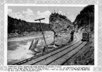 Trolley line through the gorge, Niagara Falls LCN 17290097 TROLLEY
 -
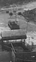
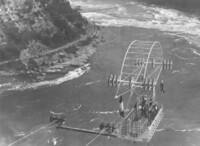
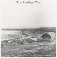 The Finished Weir LCN 10109954 ; Our Romantic Niagara
 -
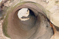 Devil's Oven Pothole LCN 10109954 ; Our Romantic Niagara
 -
 Bedded and glacial gravels at outlet of St. Davids LCN 10109954 ; Our Romantic Niagara
 -
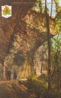
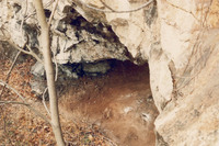 Indian Cave LCN 10109954 ; Our Romantic Niagara
 -
 Niagara Glen - Cliffs of Wintergreen Terrace Colour photograph
 -
 Niagara Glen Faded Colour photograph
 -
 An aerial view of Hydro's Intake Gates, by the upper Niagara River Negative available
 -
 Filming of IMAX mini-feature Niagara: Miracle, Myths and Magic LELAWALA HORSESHOE FALLS MAID OF MIST
 -
 Filming of IMAX mini-feature Niagara: Miracle, Myths and Magic HORSESHOE FALLS MAID OF MIST
 -
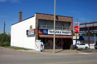 Victoria Avenue - Niagara Variety Store Historic Niagara Development Inc.
 -
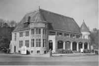
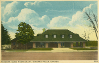 Niagara Glen Restaurant, Niagara Falls, Canada Constructed in 1925 ; also referred to as the Niagara Glen Inn
 -
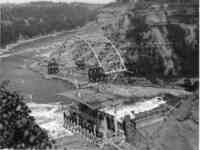
 Rankine Power Generating Station - Canadian Niagara Power Canadian Niagara Power
 -
 Rankine Power Generating Station - Canadian Niagara Power Canadian Niagara Power
 -
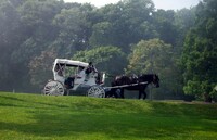 Horse and Carriage on Niagara Parkway Horse and Carriage on Niagara Parkway
 -
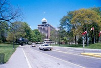
 Niagara Parkway Looking down Niagara Parkway from Queen Victoria Park
 -
 Niagara Parkway 6530 Niagara Parkway
 -
 Fall Colours - Niagara Parkway Looking East Toward Intersection With Victoria Avenue Looking east down Niagara Parkway toward Victoria Avenue
 -
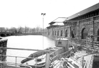
 Canadian Niagara Power Plant - Rankine Power Station : Intake Canadian Niagara Power Plant- Rankine Power Station intake reservoir with hotels and towers and casino in the background
 -
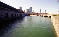 Canadian Niagara Power Plant - Rankine Power Station : Intake Canadian Niagara Power Plant - Rankine Power Station view of intake reservoir with hotels, casino and towers in the background
 -
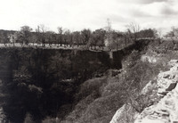
 Smeaton Ravine Smeaton Ravine is located on the Canadian side of the Niagara Gorge opposite the Floral Clock. It is the site of an infant water falls that began cutting a small gorge into the side of the existing Niagara Gorge. The ravine measures 152 meters (500 feet) long and 46 meters (150 feet) wide. The water fall was only 40 feet to the water below. The source of this water was of the then much wider version of the Niagara River that had a small branch flowing in from the west adjacent to the Niagara Gorge.
 -
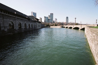
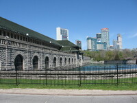
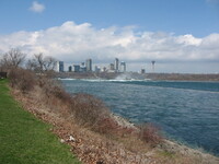
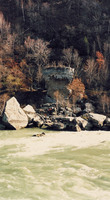
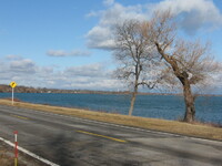 Upper Niagara River near Black Creek The Upper Niagara River near Black Creek with the Niagara Falls skyline visible in the background.
 -
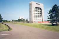
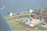
 Niagara Power Projects's Power Vista The Niagara Power Project's Power Vista: Located just 4.5 miles downstream from Niagara Falls, the Power Vista sits stop the New York Power Authority's Niagara Power Project. This admission-free visitors center contains state-of-the-art interactive exhibits on energy and electricity. Open year round, the Power Vista makes learning fun for visitors of all ages.
 -
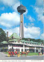 Niagara International Skylon Tower Niagara Falls, Ontario Canada. Towering above the Horseshoe Falls, the Skylon Tower soars 520 feet above the Niagara River. 648 steps link the base with the three leveled dome. Glass enclosed elevators (yellow bugs) take the visitors to the top of the Skylon. The dome's third level is an observation deck with clear-day visibility of 80 miles; the second level contains dining and cocktail lounges, while the uppermost level houses the renowned revolving dining room. Queen Victoria Place is the building situated in the front on the Niagara Parkway below the Skylon Tower.
 -
 Canadian Niagara Power Company Building Canadian Niagara Power Company building. Background : Marriott Gateway Hotel, Radisson Hotel, Marriott Fallsview Hotel & Spa, Konica Minolta Tower, Embassy Suites Hotel, Hilton Hotel & Suites
 -
 Formation of the Sediment Beds from "Our Romantic Niagara" by A.H. Tiplin The light areas on the map represent dry land during the Silurian period of the Palaeozoic Era. The Palaeozoic Era was the geological era containing the oldest forms of highly organized life, including reptiles and seed-bearing plants, dating back from 500 million to 350 million years ago. The Silurian Period, dates back 430 to 390 million years. Niagara District sedimentary deposits, mostly sandstone, shale and marine limestone, were laid down in the Silurian Period. This is the third period in geological time during the Palaezoic Era.
 -
 Wintergreen Flats, Niagara Glen Crest of the dry falls at the edge of Wintergreen Flats in the Niagara Glen
 -
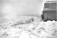
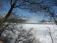 Upper Niagara River in Winter Icy conditions in the Upper Niagara River above the Horseshoe Falls. The Skylon Tower and the Sheraton on the Falls Hotel are visible in the background.
 -
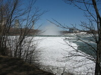 Upper Niagara River in Winter Icy conditions in the Upper Niagara River above the Horseshoe Falls. The Skylon Tower and the Sheraton on the Falls Hotel are visible in the background.
 -
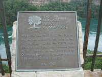 Plaque above the Lower Niagara River A plaque above the Lower Niagara River, on River Road at Queen Street. “About the year 1600 B.C., the Falls of Niagara was located at this point in the Niagara River. During the 12,000 year history of the Falls, it has receded from its initial breach of the escarpment at Queenston Heights to its present location, 3.66 km south of this location. July 1982”.
 -
 Niagara Falls skyline as seen from the upper Niagara River Marriott Hotels, Radisson Hotel, Tower Hotel, Embassy Suites Hotel, Incline Railway, Oakes Hotel, Hilton Hotes, Fallsview Casino Resort, Skylon Tower, DoubleTree Hotel and the Niagara Skywheel are visible
 -
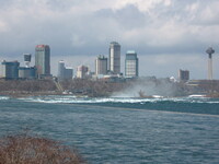 Niagara Falls skyline as seen from the upper Niagara River Marriott Hotels, Radisson Hotel, Tower Hotel, Embassy Suites Hotel, Incline Railway, Oakes Hotel, Hilton Hotes, Fallsview Casino Resort, Skylon Tower, DoubleTree Hotel and the Niagara Skywheel are visible
 -
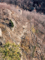
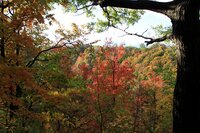 Fall Shots of Niagara Gorge Autumn leaves / changing colour / Niagara Gorge
 -
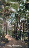
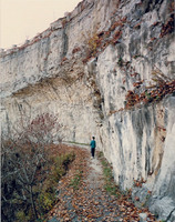
 Pretty Spot in Niagara Glen Niagara Falls Canada Stairs down to the Glen in the background
 -
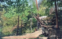
 Favourite walk in Niagara Glen Niagara Falls Canadian side Card was addressed to Miss Bertha Revell, 30 1/2 Matilda St, Toronto, Ontario, but was never mailed ;
 -
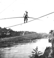 Blondin carrying Colcord on his back over the Niagara River 1859 from a stereo image by P. D. Babbitt in the Earl W. Brydges Public Library Niagara Falls N.Y.
 -
 Prospect Point LCN 17289877
 -
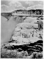 American Fall in Winter LCN 10193873 FALLS
 -
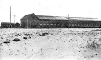
 Upper Niagara Rapids and Toronto Power Co., Power House, Niagara Falls, Canada F. H. Leslie, Publisher, Niagara Falls
 -
 Filming of IMAX mini-feature Niagara: Miracle, Myths and Magic LELAWALA HORSESHOE FALLS MAID OF MIST films movies
 -
 Niagara in winter MOVIES MOVIE FILMING FILMS COUSTEAU SOCIETY
 -
 Wilson Terrace (from above) LCN 10109954 ; Our Romantic Niagara
 -
 The "Rock of Ages" LCN 10109954 ; Our Romantic Niagara
 -
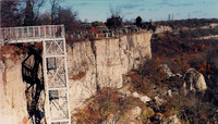 Steel stairway descending Wintergreen Terrace cliff LCN 10109954 ; Our Romantic Niagara
 -
 Scaled edge of Wintergreen Flats LCN 10109954 ; Our Romantic Niagara
 -
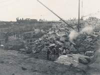 Walker Brothers Quarry LCN 10109954 ; Our Romantic Niagara
 -
 Niagara Falls with Canadian Niagara Powerplant to the Right B&W photograph
 -
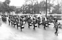 Niagara Memorial Band - later the band is called " The Niagara Memorial Militaires Drum Corps "
 -
 Horseshoe Falls and the Niagara Parkway, Canadian Niagara Power Plant in background Railway tracks of the Michigan Central Line to the right
 -
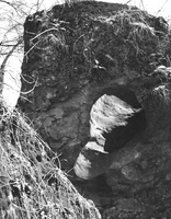
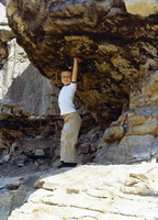 Child playing underneath an overhanging rock formation in the Niagara Gorge This photo was taken as part of the Niagara Falls International Photo Contest
 -
 Canadian Niagara Power Plant Negative is on the back of the photograph
 -
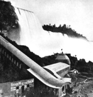
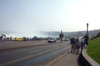
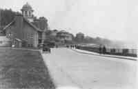 Table Rock House on the Niagara Parkway, in Niagara Falls, Ontario, ca 1912 cars, automobile, Electric Streetcar, River Rd., people, tourists
 -
 Second Table Rock House on the Niagara Parkway, Niagara Falls buildings, signs, advertisement, horse, wagon, carriage, tourists, people, River Rd.