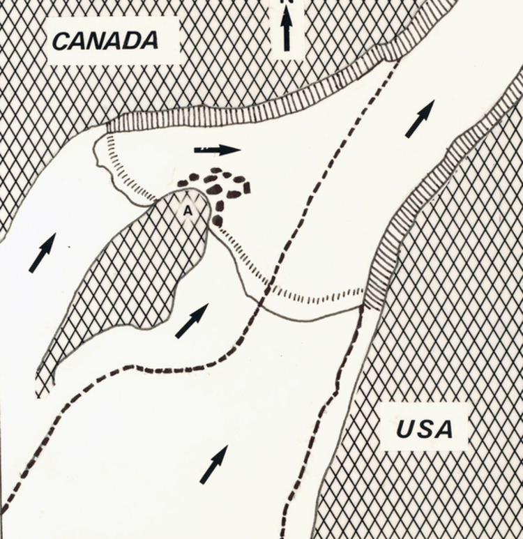
Wintergreen Flats from "Our Romantic Niagara" by A.H. Tiplin
item
- Title
- Wintergreen Flats from "Our Romantic Niagara" by A.H. Tiplin
- Description
- en-CA This map shows the position of the divided falls when it reached the present Niagara Glen area. The heavy dotted line shows the gorge, formed by the three successive cataracts from three different layers of rock, through which the river flows today. The west falls on the right was to erode back faster than its branch falls, eventually cutting off the flow of water through this channel and drying off the eastern falls. This dried-off river bed is now the Wintergreen Flats picnic area. The American Falls will some day suffer the same fate as befell this western branch falls.
- Identifier
- http://www.nflibrary.ca/nfplindex/show.asp?b=1&ref=oo&id=385777
- Creator
- Astrid Akkerman from a sketch by A.H. Tiplin
- Type
- Still Image
- Is Part Of
- Niagara Falls Public Library Digital Collections
- Extent
- 5.5" by 8"
- Medium
- Black & white sketch
- Provenance
- Niagara Falls Heritage Foundation Collection
- Date
- 1988
- Subject
- Geology - Niagara Falls
- Niagara Gorge
- Spatial Coverage
- Canada - Ontario
- Source
- Niagara Falls (Ont.) Public Library
- number
- D504820
- D504820A
- Format
- Scan from book
- Scan from book
- Date Created
- 2013-03-13
- Date Modified
- 2013-03-13